Understand your local risk

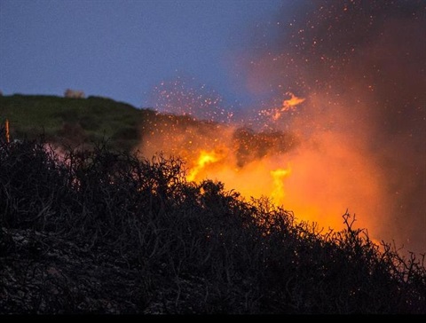
Lismore is surrounded by bush, making it susceptible to fire risk. A bush or grass fire can occur any time throughout the year, but it is more likely when the bush, grass, or scrub is drier during the warmer summer months. You do not have to live near the bush to be at risk. You may still experience indirect impacts such as temporary isolation or loss of essential services like electricity and communications.
Staying informed of potential hazards, ensuring your property and home are prepared, creating a bushfire survival plan and pet and animal emergency plan, preparing an emergency survival kit and considering your physical, mental and emotional readiness can substantially reduce your vulnerability.
Likewise, it is important to understand the impact of grassfires, how to protect your property, and what to do if you are threatened, and make sure you have the right clothes and shoes in your wardrobe to wear during a bushfire. Also, ensure your rainwater tank is adequately protected to help avoid contamination during a bushfire.
If you live in an area close to the bush, check whether you are in the 10/50 Vegetation Clearing Entitlement Area so you can take extra precautions to minimise your bushfire risk.
Farmers and landholders
If you own or operate a farm, in partnership with the NSW Farmers Association, the NSW Rural Fire Service has developed specific resources for farmers, including a Farm Fire Plan and information on how to protect livestock and large animals, to help you mitigate and respond to fire threats.
If you are a landholder in an identified bushfire-prone, rural-zoned area, follow the NSW Government Rural Boundary Clearing Code to guide you on removing vegetation from your property boundary to help prevent fire spreading. Please note that heavy penalties apply if the environmental protection requirements are not upheld. Consult these boundary clearing FAQs for more information.
Bushfire household assessment tool
By understanding the specific risks in your locality, you can take proactive steps to minimise harm and safeguard your household before, during and after a bushfire event. Determine your risk using the NSW RFS bushfire household assessment tool. The tool is designed to help you make informed decisions when making your bushfire survival plan.
Fire Danger Ratings
The NSW RFS Fire Danger Ratings outline the consequences of a fire, should one start. Ranging from moderate to catastrophic, they can be used as a trigger for action in your bushfire survival plan, such as leaving bushfire risk areas on days rated as extreme or catastrophic fire danger. This video from the Bureau of Meteorology (BoM) explains how weather conditions influence the size, intensity and speed of bushfires (and how dangerous they can be to the community). Fire danger ratings and total fire bans in your area can be checked here.
Interactive maps
Finally, to locate bushfire-prone areas in and around Lismore, use Council’s IntraMaps pages. (Select Environmental Natural from the list and click Bushfire Vegetation 2009.)