Past floods
Lismore's location in a floodplain places us at risk of flooding during weather events.
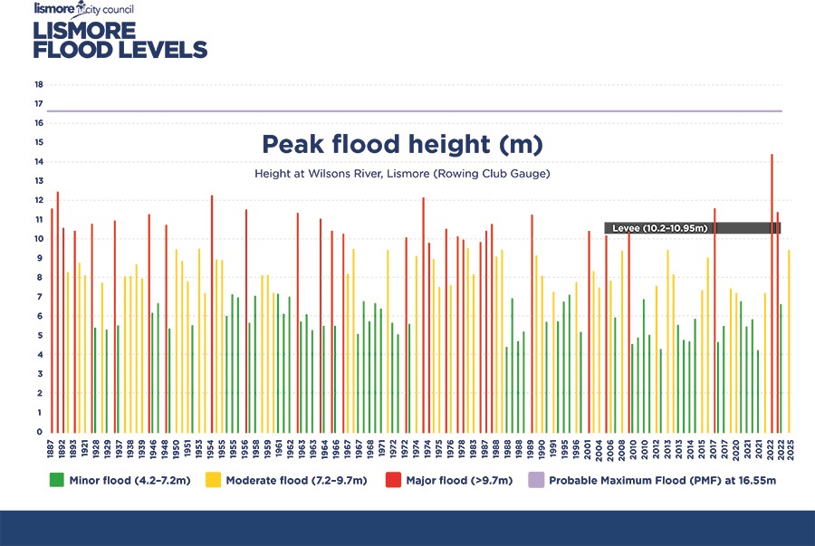
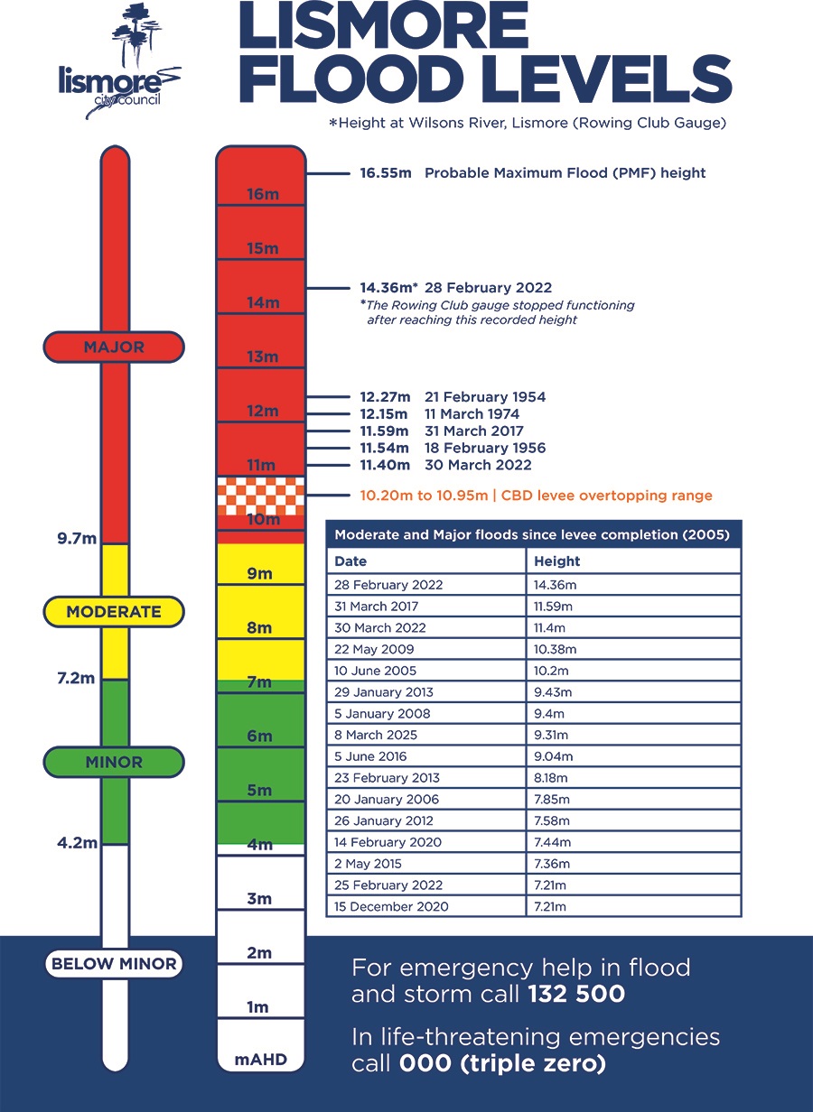
The graph below provides information on historical peak flood heights. All heights indicated are based on measurements from the Lismore AHD gauge (located at the Lismore Rowing Club). Flood height will vary across the floodplain.
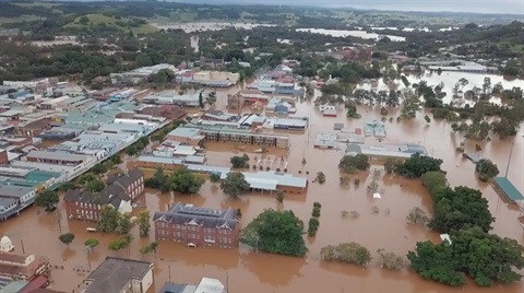
The highest flood on record in Lismore was on 28 February 2022, when the flood level reached 14.4m.
Before this extreme rainfall event, the record was held at 12.11m, with floods in February 1954 and March 1974 reaching this height. The flood in March 2017 reached a level of 11.6m.
Between March 6 and 10, 2025, Tropical Cyclone Alfred brought heavy rainfall to Lismore, causing the Wilsons River to peak at 9.31m, just below the major flood level of 9.70m. Widespread flooding affected the CBD and residential areas, prompting evacuation orders. The State Emergency Service (SES) conducted multiple rescues as roads became impassable, disrupting essential services and power to thousands of properties. Emergency services, including the Australian Defence Force, assisted with evacuations, rescues and supply distribution.
In the property flood information section, you can find flood information for a specific property including existing floor levels.
Flooding Impacts & Recovery Statement
The Lismore Flooding Impacts & Recovery Statement evaluates the effects of the February and March 2022 natural disaster on the local economy and identifies the recovery needs of Lismore's communities.
Please note that this report was developed early in the recovery process and some considerations may be preliminary or unresolved.
Contact the council's Economic Development Team for more information on (02) 6625 0500 or business@lismore.nsw.gov.au.
Flood Response Report
Lismore City Council's Flood Response Report estimates that the natural disaster and flood of February and March caused more than $350 million in damage to Council assets, including $200 million in road and bridge damage, $108 million in water and wastewater infrastructure damage, up to $20 million in waste and resource recovery damage, and $20 million in damage to Council facilities and depots.
The report estimates that the total cost of rebuilding the community will be close to $1 billion.